Technical Review Committee held
Dec 10, 2025
The staff report says TRC review was held on December 10, 2025.
Development
3,700 Homes•1,052.7 Acres
Brunswick County
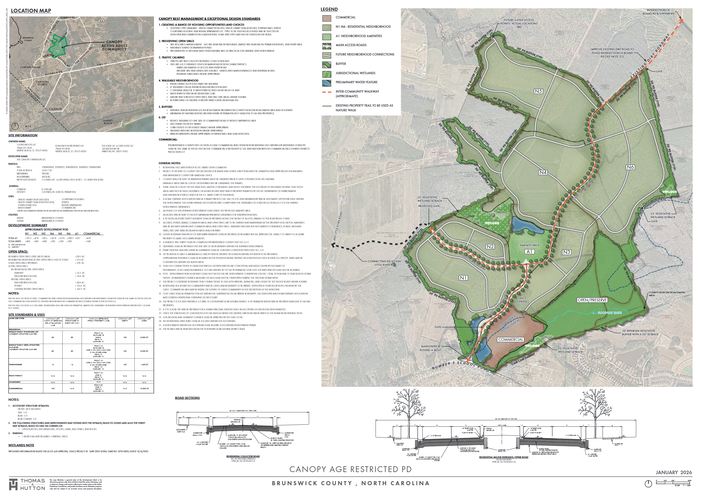
Canopy Planned Development is a proposed age-restricted mixed-use planned development near Ash in Brunswick County. The March 9, 2026 Planning Board packet describes 3,700 senior adult residential units on about 1,052.7 acres off No. 5 School Road, with an overall density of 3.51 units per acre and 47 acres of proposed commercial area. The project includes private roads, Brunswick County water and sewer service, dedicated open space, recreation space, buffers, internal sidewalks, and traffic improvements identified through a Traffic Impact Analysis.
Homes Proposed
3,700
Acres
1,052.7
Density
3.51 units/ac
Daily Vehicle Trips
Not entered
Verified Milestones
Dec 10, 2025
The staff report says TRC review was held on December 10, 2025.
Dec 17, 2025
The staff report says a neighborhood meeting was held on December 17, 2025.
The Canopy age-restricted planned development site plan in the packet is dated January 2026.
Mar 9, 2026
The March 9, 2026 Planning Board packet includes PD-167 Canopy Mixed Use Planned Development as an action item, with staff recommending approval subject to conditions.
Final Planning Board action and any later conditions should be verified from the meeting minutes or county project record before final publication.
Interactive Plans
Select a graphic, then open it for full-resolution zoom.
Public Record
No updates in this category.
Location Reference
Use the map to zoom, pan, and understand nearby roads. Brunswick GIS remains the official parcel source.
No. 5 School Road (SR 1305) near Ash and Longwood in Brunswick County, with traffic improvements tied to No. 5 School Road, Pea Landing Road, US 17, Ash Little River Road, and Hickman Road.
Official planning context
Project zoning comes from the planning record. GIS intersections describe the full matched parcel and are informational, not legal surveys.
2026-03-09
Brunswick County Planning staff recommended approval of PD-167 Canopy Planned Development for Planning Board consideration on March 9, 2026.