Original master development plan approved
Jun 2, 2017
The 2025 county package states that the original Lanes Ferry Landing master development plan was approved on June 2, 2017.
Development
2,750 Homes•976.58 Acres
Pender
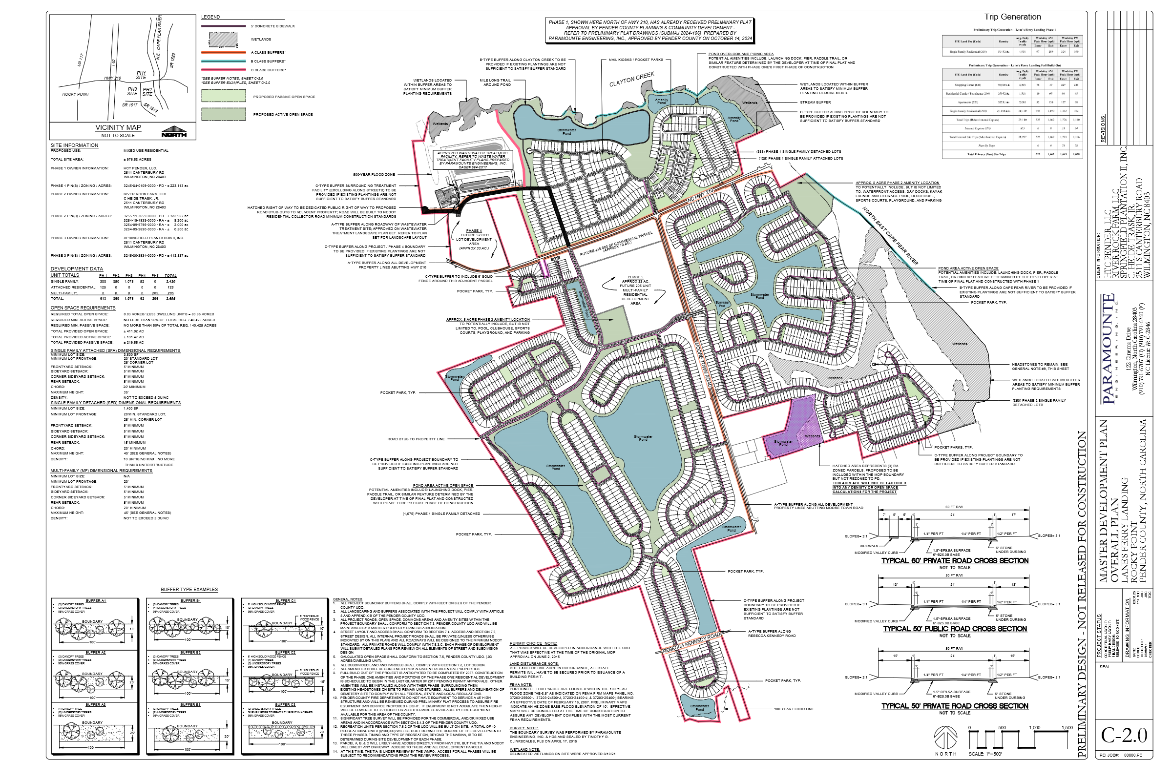
Lanes Ferry Landing is a proposed revision to a very large mixed-use residential master development plan in Rocky Point. The county package describes about 976.58 acres around NC 210 and Moore Town Road, with proposed residential neighborhoods, commercial land, amenity centers, walking trails, parks, sidewalks, wetlands, floodplain areas, and access points from NC 210 and Moore Town Road. The 2025 package lists 2,420 single-family detached units, 125 attached or townhome units, 205 multifamily units, and about 10 acres for roughly 15,000 square feet of commercial use.
Homes Proposed
2,750
Acres
976.58
Density
2.82 units/ac
Daily Vehicle Trips
Not entered
Verified Milestones
Jun 2, 2017
The 2025 county package states that the original Lanes Ferry Landing master development plan was approved on June 2, 2017.
Dec 30, 2020
The 2025 package states that a subsequent revision was approved on December 30, 2020.
Aug 15, 2025
Pender County's Master Development Plans page lists MDP 2025-86 Lanes Ferry as pending with a last updated date of August 15, 2025.
Final county action, conditions, and any corrected unit cap should be verified from county records before final publication.
Interactive Plans
Select a graphic, then open it for full-resolution zoom.
Public Record
No updates in this category.
Location Reference
Use the map to zoom, pan, and understand nearby roads. Pender GIS remains the official parcel source.
North and south of NC Highway 210 at Moore Town Road, about 1.8 miles east of I-40 Exit 408 in the Rocky Point District.
Official planning context
Project zoning comes from the planning record. GIS intersections describe the full matched parcel and are informational, not legal surveys.
2025-08-15
Pender County lists MDP 2025-86 Lanes Ferry as pending, last updated August 15, 2025.